Harold Parker State Forest, which lies in Andover, North Andover, North Reading and Middleton, comprises just over 3,000 acres of Central Hardwood-Hemlock-White Pine type of forest. The forest is twenty miles north of Boston and within one hour’s drive of three million people. Recreational opportunities include hiking, mountain biking, fishing, hunting, horseback riding, camping and picnicking. The forest has over 35 miles of logging roads and trails and offers quiet seclusion to off-road hikers and bikers. [source]
On a mild yet wet December day, on the eve of the eve of Christmas, I decided to head out to Harold Parker State Forest for a second visit. On my first visit in early November I learned that this vast and beautiful forest is broken up into different segments and many of those segments allow hunting. I had heard a gunshot way too close for comfort while exploring the Salem Pond area. I returned to explore an area I knew was safe from hunters: the Brackett Pond area. From here you still might hear distant gunshots from a shooting range in the area.
The parking area for these trails is easy to access. From I-93, take Exit 41 for 125 North toward Andover. Follow 125 North for about 4 miles and turn right onto Harold Parker Rd. The parking area will soon be on your left. There are other places to park and access trails along Howard Parker Rd but this larger parking area has a map and garbage barrel.

If you forget to print out a map (you can find one here) and there isn’t a paper map available, I recommend taking a photo of the map posted on the board. It’s just one of a few ways you can keep a map handy on your phone. Speaking of phones, I did not lose service at any point on this hike, nor did my WalkForADog app ever shut down. The app tracked my total mileage for this visit at 4.62 miles.
I took the trail directly to the right of the sign. This leads to Brackett Pond and you may notice what appears to be a dam on your right. At this point I let the dogs off leash and they immediately head for the water.
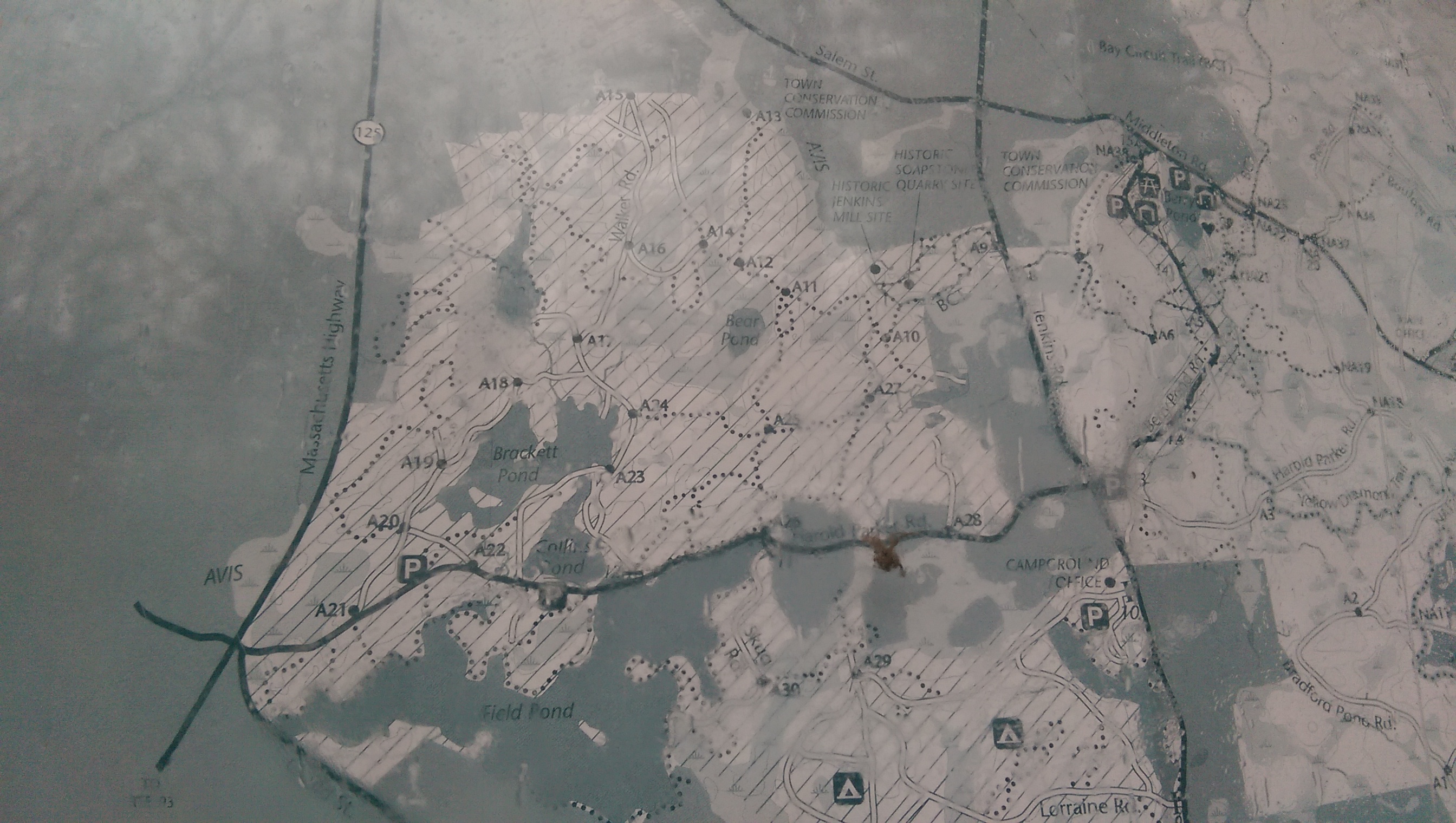
The trails aren’t well marked but they do have numbered posts that correspond to numbers on the map but now that I look at the map I linked to above, I notice that the numbers are missing. Here’s the map as pictured at the parking area. As I said, it was a wet day so the sign was wet and the photo isn’t clear (click on the images to enlarge them).
I took a trail along the left side of Brackett that doesn’t appear on the map but it’s a clear trail and eventually led me to marker A18. I turned left here and headed to Delano Pond. I followed the trail along the right side of Delano Pond. Here you’ll find this interesting dam.
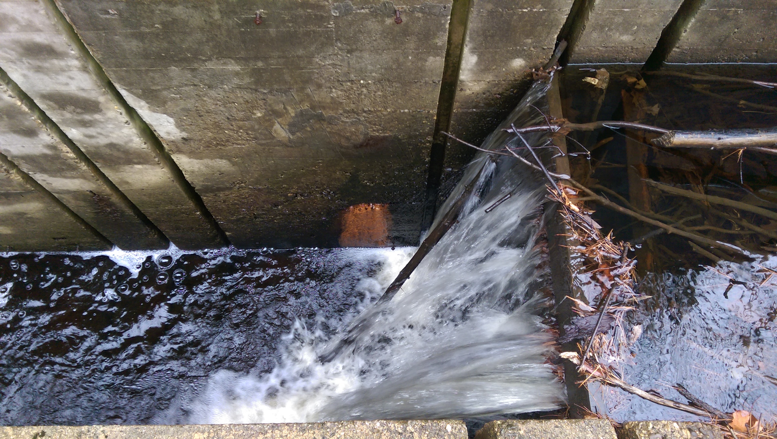
If you get up close to it, you’ll notice that it’s got quite a drop!
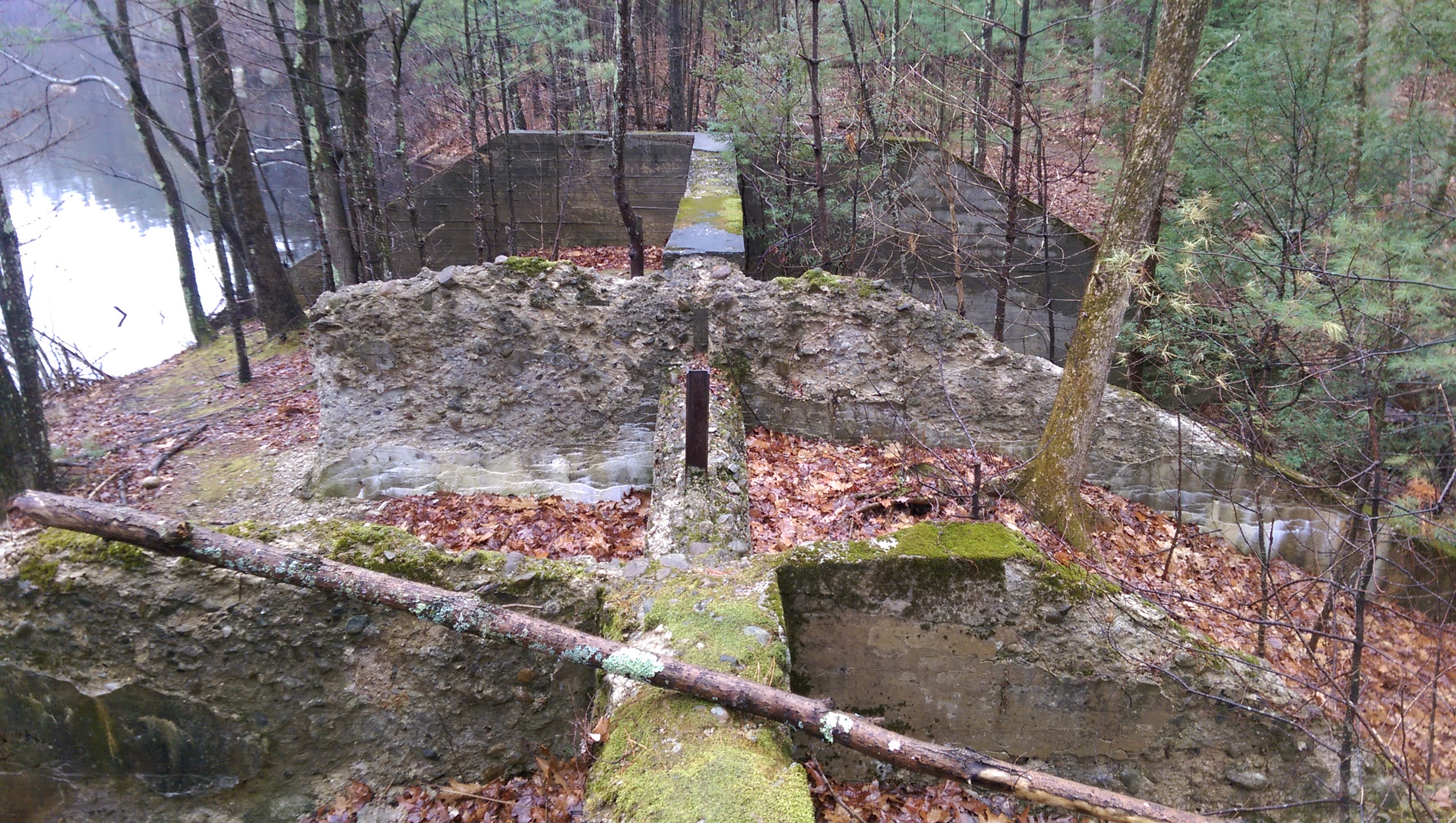
I continued along the edge of Delano Pond, crossing a creek and soon the trail looks to head towards some private homes. Fear not, the trail looped around back into the woods and back over the creek. Checking my location on Google maps because I couldn’t easily identify where I was on the trail map, I headed in the direction of ‘back into the forest’ and found myself on a trail that was something out of a fairy tale. It loops and loops and loops again, turning you in one direction and then another, up and down a small hill, between and over boulders. You might feel like it’s throwing you off course or getting you completely lost but trust that it’s really not. You eventually find yourself face to face with this enormous ‘structure’, for lack of a better word. The photo does not do its size justice.
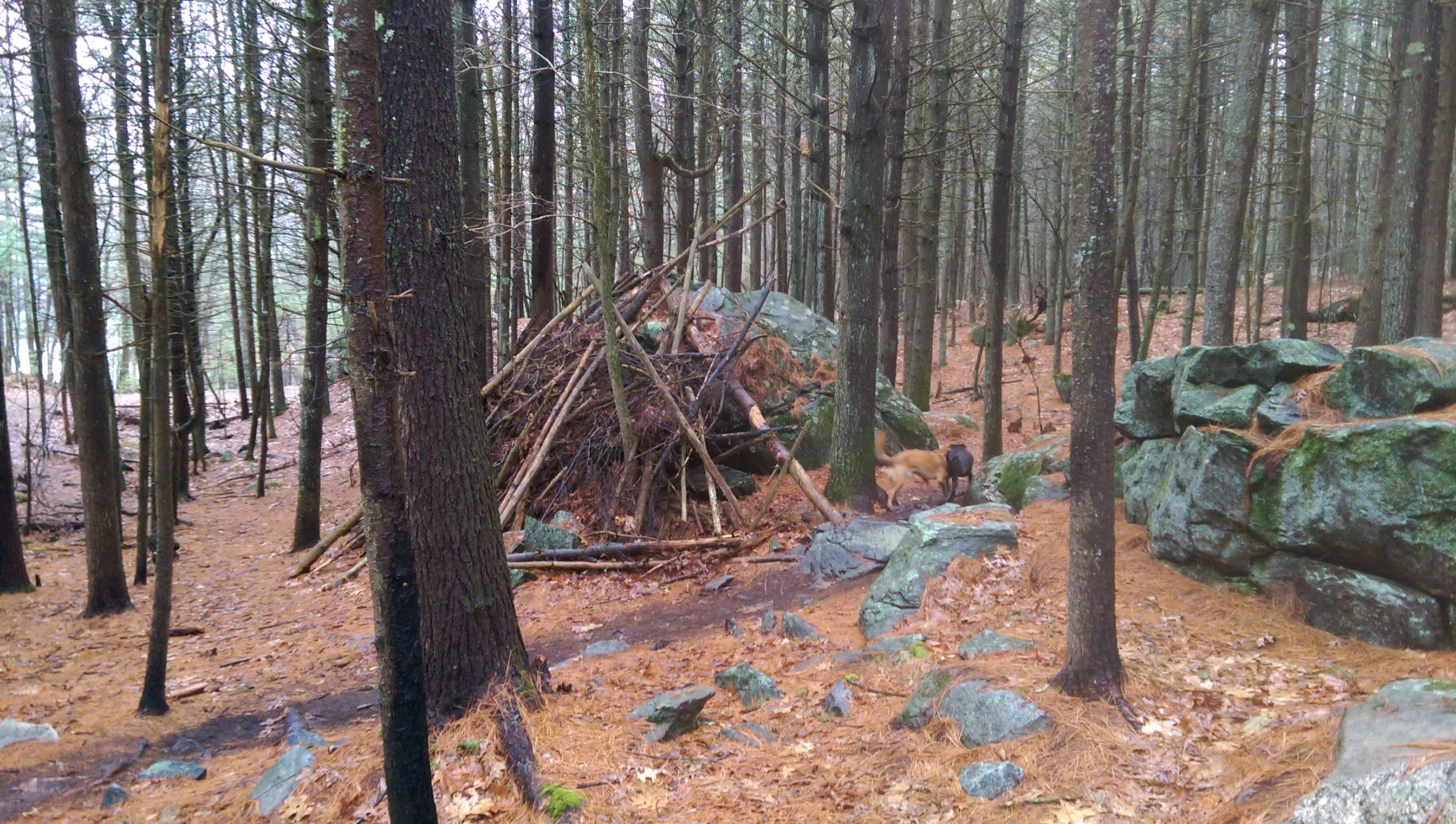
Honestly, I didn’t want to pass too close to this structure not knowing what could possibly be lurking inside (even the dogs didn’t investigate!) so I cut through the woods to what appeared to be Walker Rd and turned left. I took a trail to the right that appeared to be the cut off before marker A16. On my right were wetlands that looked intriguing. Between markers A16 and A14, notice a horse-shoe shaped trail on the map. This leads you out to a point where you can view this fascinating habitat.
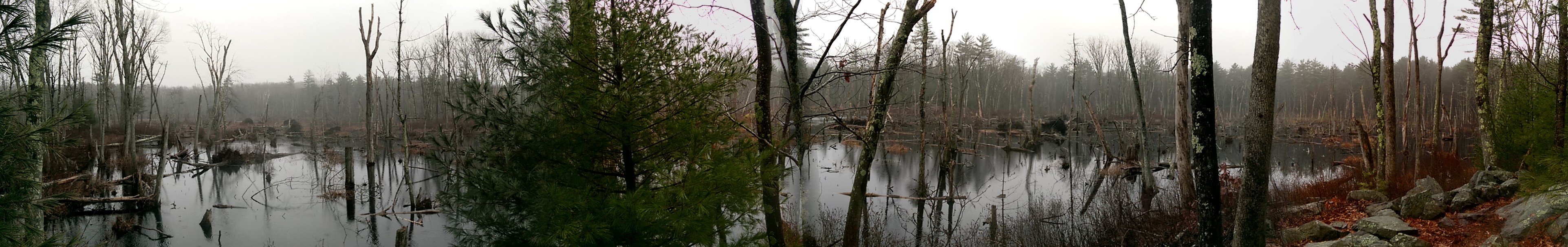
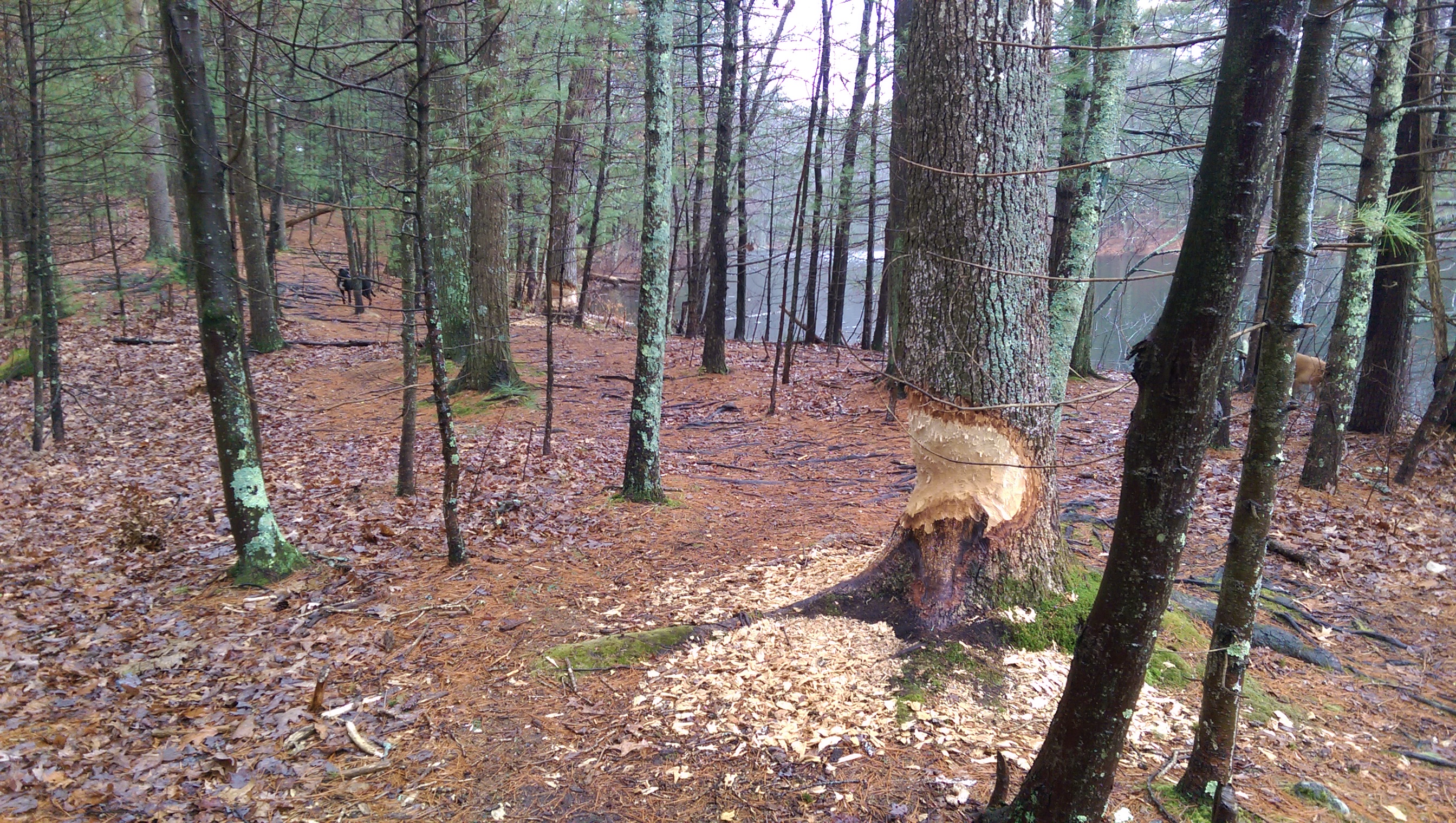
Following the trail to marker A14, I turned right. This led over a wooden walkway. My dog Stitch first took the dry walkway, turned around and came back, and then plopped himself in the water and went that way instead. Go figure. I continued past A12 and turned right at A11. The trail leads over neat rock formations, through old stone boundaries, with a pretty view of Bear Pond on your right. At A24, you’ve returned to Brackett Pond and yet another dam between Brackett and Collins Pond (A23). This is a beautiful spot and the beaver activity here is evident and obviously recent. I have yet to see an actual beaver on any of my hikes.
At this point you’ll start to hear road traffic again. I was ready to head back to my car. I suspect that the first damn we came to was once passable but today there were only a couple small tree trunks laying across one side of it and they didn’t look very sturdy so I leashed the dogs and instead headed towards the road to head back to the parking area. The road doesn’t have much of a shoulder, so use caution.
Even though this was a soggy day, I didn’t find the trails too muddy. I didn’t even have to hose the dogs down when I got home. I had these trails all to myself and never crossed paths with another person. Maybe it was the weather, maybe it was because of the holiday. On a different day I suspect there would be quite a few bicyclists here and maybe another dog or 2. I look forward to returning and exploring more trails!
Leave a Reply