
I am often asked how I find the many trails the pups and I explore. My short answer is: Google. But sometimes it takes just as much exploring online to find our way as it does in the woods. In the case of the Wharton Plantation trails, I started with the knowledge that the New England Forestry Foundation (NEFF) manages other trails in the area that I and my two dogs already frequent: Groton Place, also in Groton, and Proutty Woods in Littleton, where NEFF is also headquartered. There is a handy interactive map on the NEFF website marked with tree icons representing NEFF managed forests. I simply clicked on a tree in an area I wanted to explore and this opened a page with more details on that area. Unfortunately, the Wharton Plantation detail page was lacking some crucial details – like a trail map – so this led me to a bit more Googling. I was quickly able to find a Facebook event (from 2013) on the Groton Trails Network Facebook page that provided instructions for parking, a helpful trail description and a mapped route. Here is the map they provided. It proved invaluable because this map is also a satellite view – I was able to identify that I had missed a turn when I reached the carved out path of massive power-lines that are visible on the satellite view.
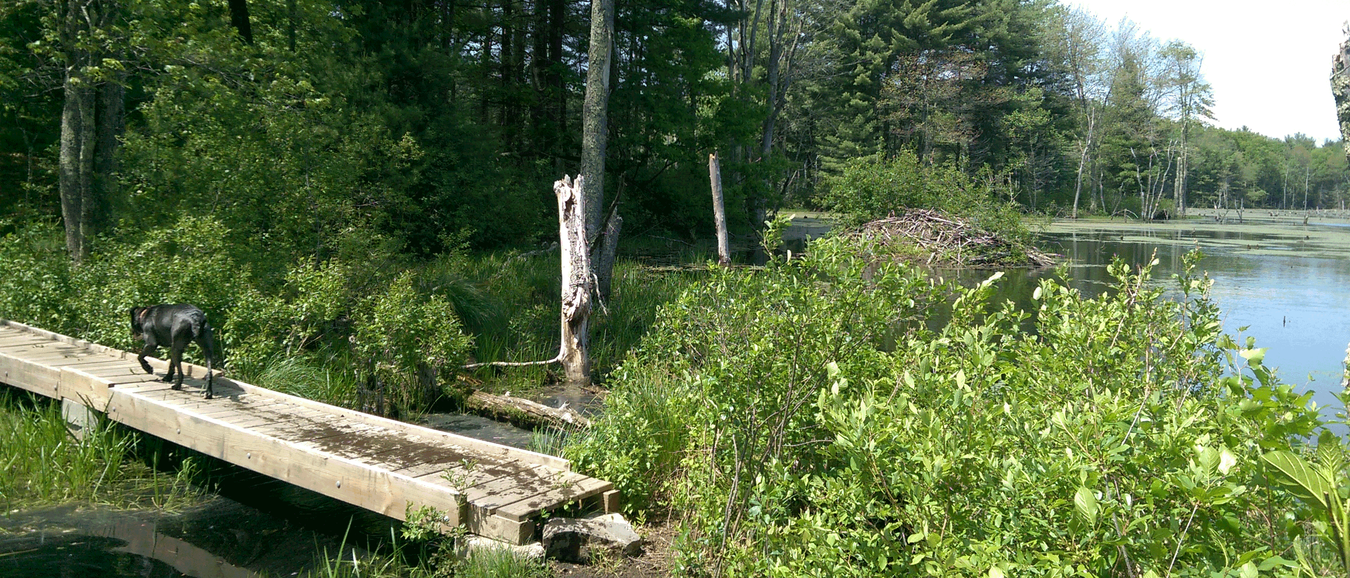
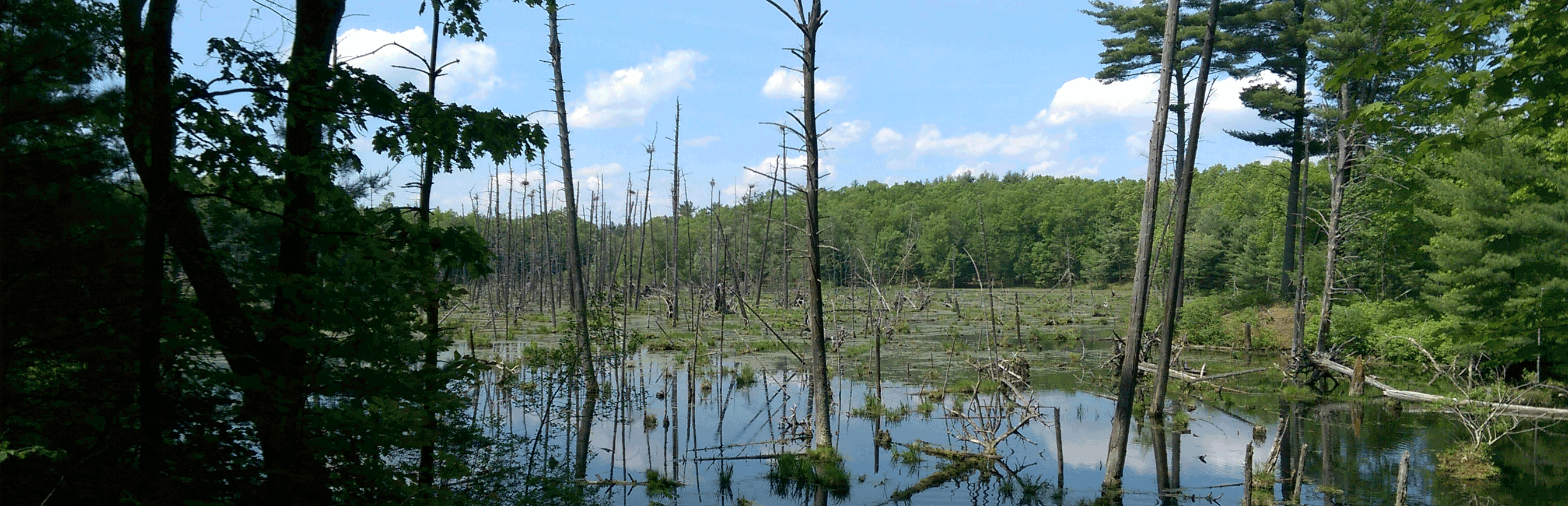
NEFF describes the Wharton Plantation as follows: “Mr. William P. Wharton, one of the original incorporators of the New England Forestry Foundation, deeded this land to NEFF in 1968. The land was pieced together by Mr. Wharton over many years as abutting parcels came on the market. The property was originally abandoned farm land, which Mr. Wharton had planted into pine plantations, hence the name, Wharton Plantation. The property surrounds two sides of Baddacook Pond, a secondary source of drinking water for the town of Groton. There are extensive trail systems throughout the property. Recent beaver activity has added significant wetland acreage. The property contains an active heron rookery.”
rook·er·y – noun – a breeding colony of rooks, typically seen as a collection of nests high in a clump of trees.
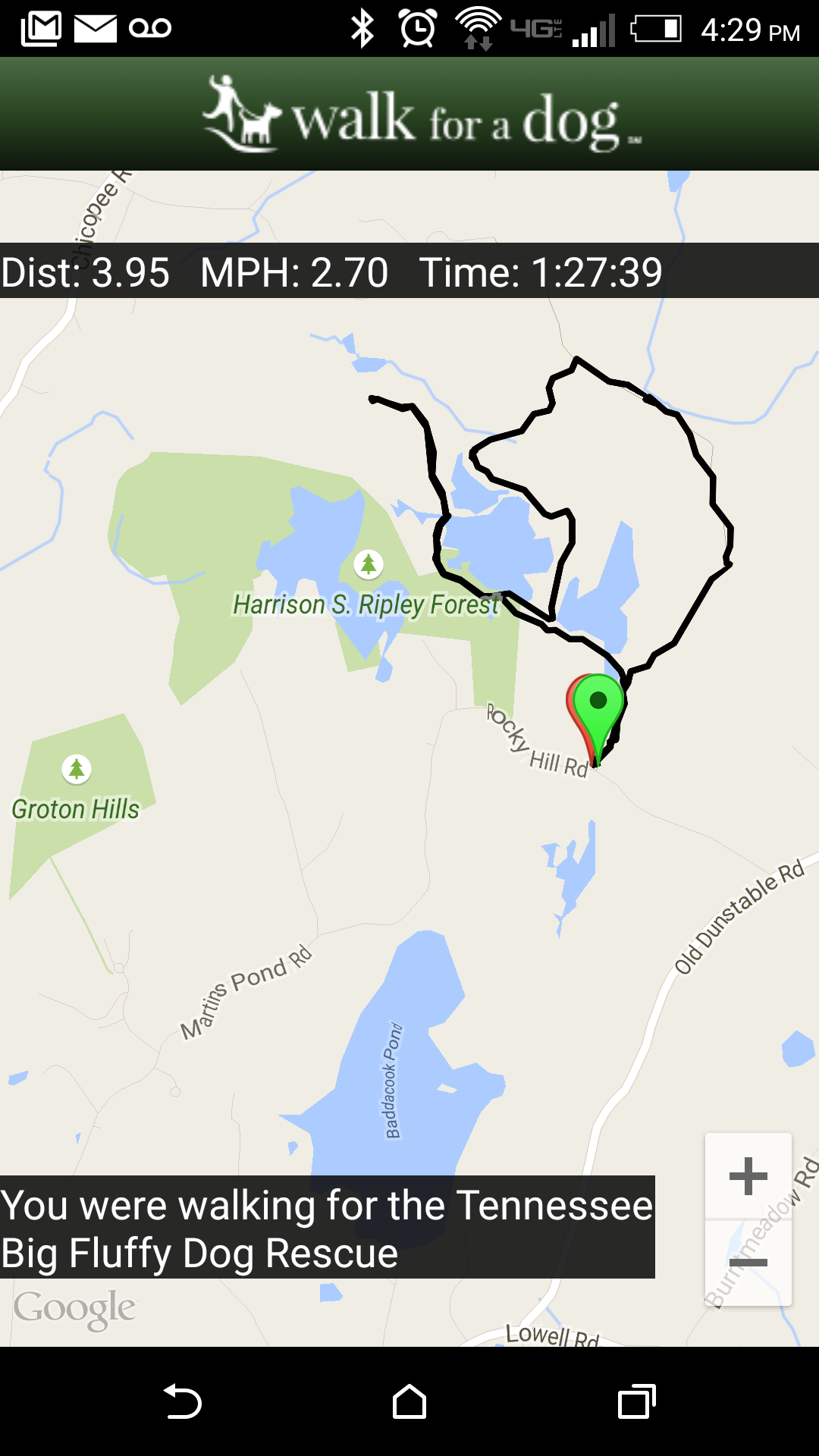
There is plenty of water along these trails and quite a bit of mud so I highly recommend drenching yourself in bug spray, wearing waterproof shoes, and treating your pooches for tick prevention. Bring water for yourself, sustenance/snacks and a well-charged phone in case you get lost. The first section of trail was blazed with Groton Trail Network badges but I lost them at some point and didn’t see any blazes for most of my hike. My Walk-for-a-Dog app managed to work for my entire hike (I checked it after every photo I took).
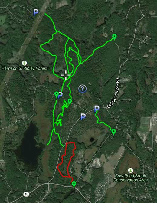
The well-marked entrance is located on graveled Rocky Hill Rd where the pavement begins for Martins Pond Rd, off of Old Dunstable Rd in Groton, MA. I put the cross streets of Rocky Hill Rd and Old Dunstable Rd in my GPS and this got me close enough to easily find the trail-head. The trail entrance has room for a few cars to park off the street, a large sign and a gate, but it does not have a trail map.
A short way down the trail you reach a split with a pond located below you on your left. Taking the path to the left will take you through the most scenic part of the hike – beside and between beautiful ponds that are home to heron rookeries and very busy beavers.
After crossing the bridge, you reach another trail-split. The trail to the right appeared to go down along the pond. To the left the trail appears to lead up a ridge, perhaps an esker. I took the trail to the left because it was blazed with Groton Trail Network badges. It wasn’t until I reached the massive power-lines, and noticed the badges had ceased appearing, that I double-checked my map and realized I had missed a turn somewhere. I doubled back, this time staying on the low trail, and found the turn that took me between the ponds. This mistake at least allowed me to see even more of the heron rookery, which I have never seen before. I suspect you could find another way around the ponds through the neighboring conservation land (the trail continues under the power-lines) but I wanted to stick to the mapped route I had so that I didn’t get completely lost.
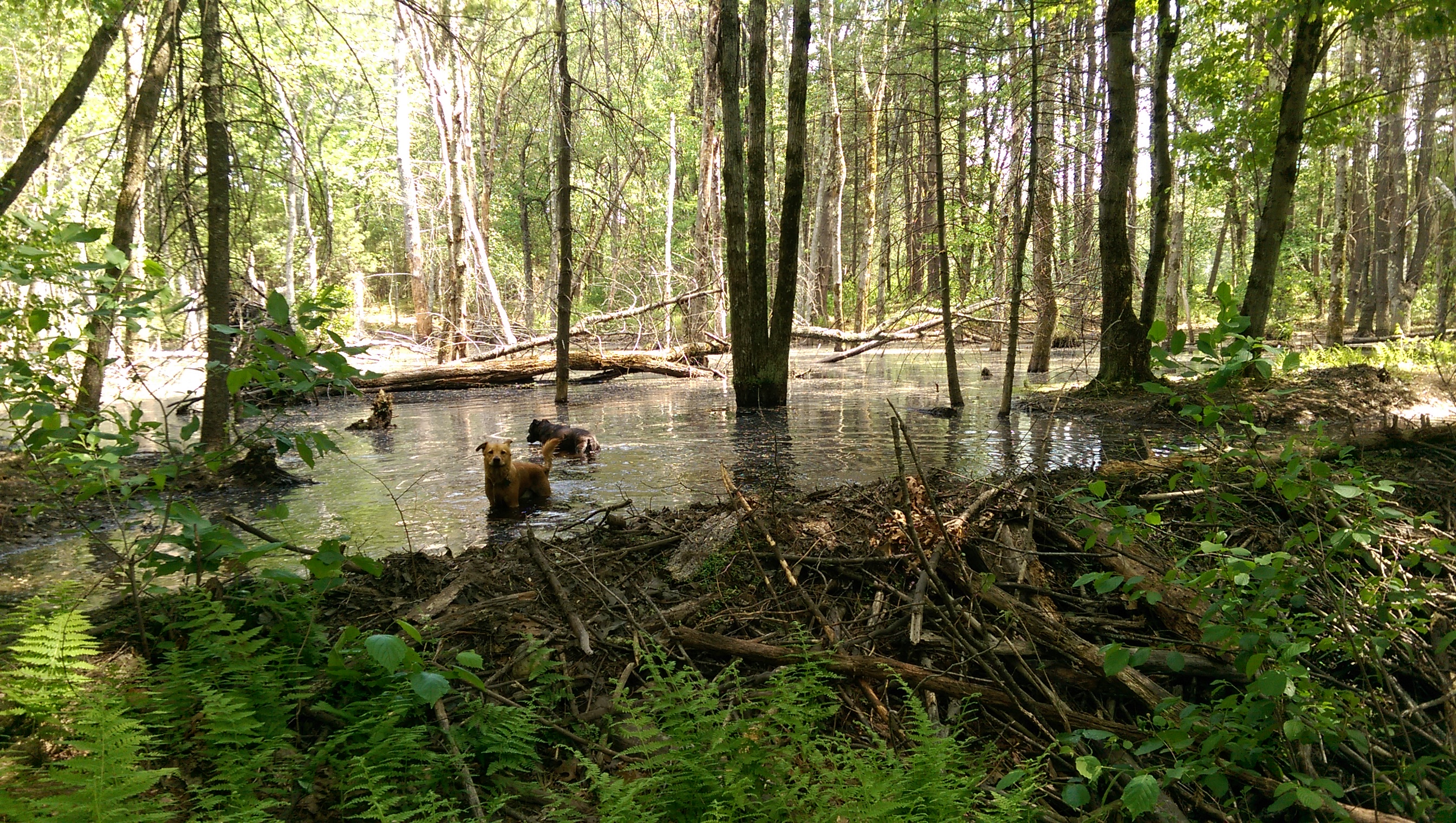
Beaver activity is evident and is evidently changing the landscape here. One particular trail-crossing looked flooded by a beaver dam but I was able to pass easily just below the dam while the dogs took advantage of the beaver-formed pond.
When the trail leads away from the ponds you’ll reach an obvious intersection with what appears to be a dirt road. I took a right here. Judging by the map, a left turn will take you out to a different trail-head/parking area. This section of trail is dry and has a moderate uphill climb. There appears to be some clearing along this trail (perhaps the recent harvest?) and follows an old rock wall boundary. I stayed straight when I came to another intersection and soon I found myself at the original trail-split where I started. Here the pups had a chance to cool off one more time in the pond below the trail.
I did just under 4 miles in about an hour and a half. We completed this hike on a Tuesday and had these trails all to ourselves. I saw evidence of horses, bicycles and other dogs so maybe a weekend visit is a bit more popular. I hope to include some alternate loops in a future visit – there are so many other trails to explore in this area! It’s beautiful and well worth the visit – just don’t forget the bug spray!
Leave a Reply